
Aerial Topographic Surveys in Los Angeles
An aerial topographic survey is used to document elevations, terrain, and visible site features across large or difficult-to-access properties. It can be especially useful when steep slopes, rugged terrain, limited access, or the size of the property make ground-based data collection less practical.
M&M&Co. provides aerial topographic surveying services throughout Los Angeles and Ventura Counties. With more than 30 years of surveying experience, our team can help determine whether aerial topography, ground-based surveying, or a combination of both is appropriate for your project.
This site is protected by reCAPTCHA, and the Google Privacy Policy and Terms of Service apply.
Why would I need an aerial topographic survey?
Aerial topography can be useful when a project requires survey information across a large area or where ground access is limited.
Common situations include:
- Large properties where collecting topographic information entirely from the ground may be less practical
- Steep, rugged, or difficult terrain
- Areas with limited vehicle or foot access because of fencing, lack of roads or paths, or neighboring-property restrictions
- Projects where a city or government agency requires topography or visible site features beyond the subject property
- Early project planning where broader information about terrain, elevations, and surrounding conditions is needed
Depending on the project, aerial data may be supplemented with an on-the-ground survey where greater detail or accuracy is required.
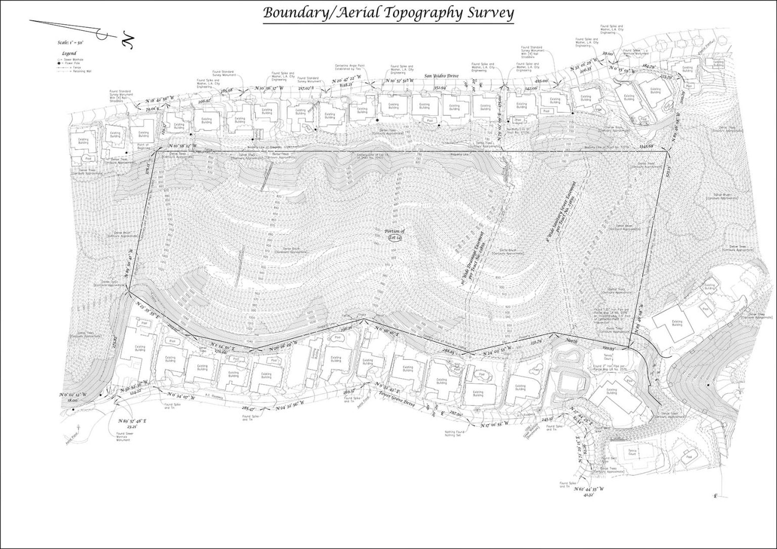
Services
We will provide a map including the following items throughout, and immediately surrounding, the subject property:
Subject property lines
Roads
Buildings (roof footprint)
Visible utilities
Tree Canopies
Contours

What does an aerial topographic survey include?
Depending on the agreed project scope, M&M&Co. can prepare a map showing features throughout and immediately surrounding the subject property, including:
- Subject property lines
- Roads
- Building roof footprints
- Visible utilities
- Tree canopies
- Contours and elevation information
The exact scope depends on the property and how the survey will be used. If additional detail is needed in specific areas, ground-based surveying may also be recommended.
Aerial topography vs. ground-based topographic surveying
Aerial topography collects information across a property from above and can be especially useful for large, remote, steep, or difficult-to-access sites. It allows broad terrain and feature information to be documented efficiently across a larger area.
Ground-based surveying is generally used when a project requires more detailed measurements in specific areas. For some projects, the best approach may include both aerial and ground-based data collection.
Our team can review your property and project requirements to help determine which approach is appropriate.


Who uses aerial topographic surveys?
Aerial topographic information may support a variety of property and project workflows, including work performed by:
- Property owners evaluating large or difficult sites
- Architects and designers preparing for site planning
- Engineers reviewing terrain and existing conditions
- Contractors and construction teams coordinating project planning
- Developers evaluating property conditions
- Other project professionals who need broader information about elevations, terrain, and visible site features
We work with homeowners and professional project teams to make sure the survey scope reflects the information needed for the next phase of work.
FAQ
What is an aerial topography survey?
An aerial topographic survey collects information about a property’s terrain, elevations, and visible site features from above. It is commonly used for larger properties or sites where steep terrain, limited access, or other conditions make traditional ground-based data collection more difficult.
The resulting information can be used to prepare a topographic map showing features such as contours, roads, buildings, property lines, visible utilities, and tree canopies depending on the project scope.
An aerial topography survey is a modern surveying method that uses drones or aircraft equipped with cameras and LiDAR technology to capture detailed land elevation data from above. This process creates accurate 3D models and topographic maps, which are essential for construction planning, land development, and environmental studies.
Unlike traditional ground-based surveys, aerial surveys allow large areas to be covered quickly and efficiently, reducing the time and labor required. At M&M&Co, we specialize in using advanced aerial technologies to deliver precise, high-quality results that meet the unique needs of your project.
When can you start?
Our proposal will include an estimated start-date for field work. This service will require an additional 2-3 weeks to gather and process the necessary data. Adverse weather such as fog or rain may impact flight schedules and cause further delays.
Is aerial topography sufficient for design?
Aerial topography is not intended for design use. An on-the-ground survey will be necessary for areas that require a greater amount of detail and accuracy. Contours in areas of dense brush will be approximate.
Will you be setting markers at the property corners?
Setting markers at the property corners or along property lines is not included but may be added for an additional fee. Refer to “Boundary Staking” for more details.
What do you need from us?
We will gather the documents necessary for conducting our survey. If you want us to plot easements you will need to provide a title report and underlying documents. If you cannot provide these documents we can order them for an additional fee.
What are the benefits of using aerial surveys for topography?
Aerial surveying can make it practical to collect topographic and visible-feature information across large, steep, rugged, or difficult-to-access properties.
It can also help document areas where vehicle or foot access is limited and provide broader site information when a project requires mapping beyond the immediate subject property.
What is the difference between aerial and traditional topography surveys?
Aerial topographic surveying collects broad terrain and site information from above, making it useful for large or difficult-to-access properties. Traditional ground-based surveying collects measurements directly in the field and is generally used where greater detail is required.
Some projects may use both methods depending on the property conditions and project requirements.
What to expect
The process begins with a consultation so we can understand the property, project requirements, and level of information needed.
After reviewing the project scope, we prepare a proposal and schedule the necessary data collection. Once the information has been gathered, our team processes the survey data, prepares the map, and reviews the final deliverables before providing them to the client.
If portions of the property require more detailed ground-based measurements, we can identify those needs as part of the project scope.
Need an aerial topographic survey in Los Angeles or Ventura County?
Tell us about your property, terrain, and project requirements. Our team can help determine whether aerial topography, ground-based surveying, or a combination of services is the right approach.