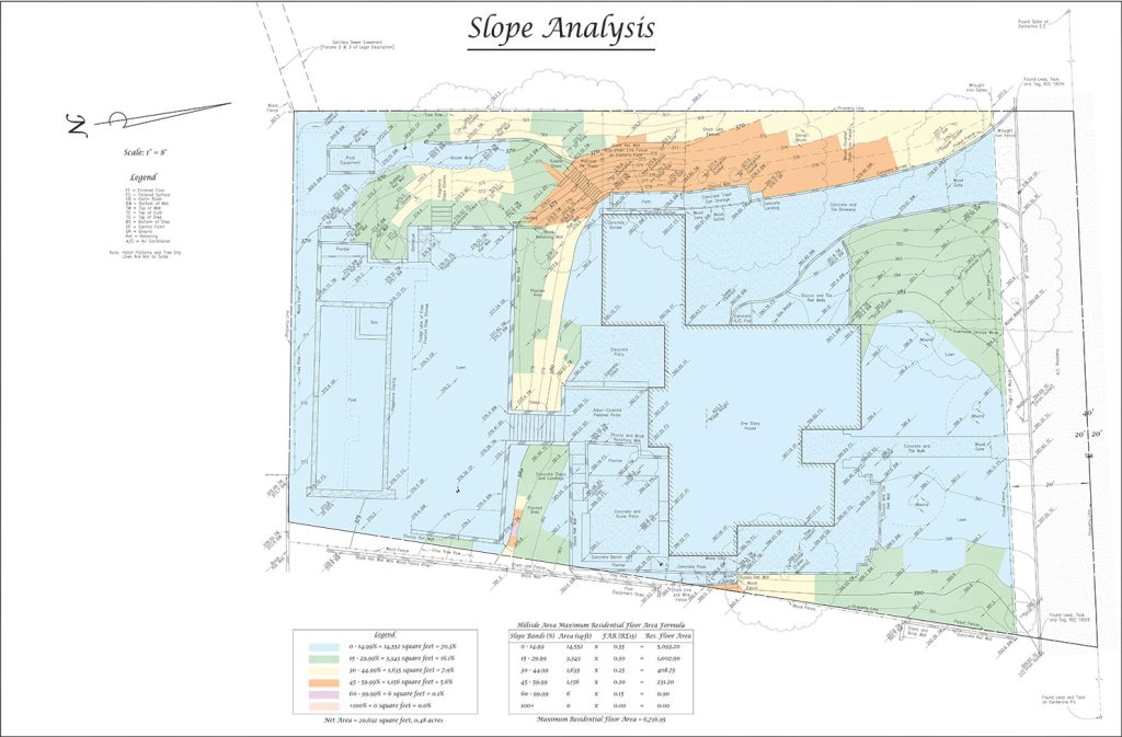
Los Angeles Slope Analysis Services
Assess slope conditions and maximize your residential square footage with a professional analysis today.
For over 30 years, we have been providing trusted slope analysis services to Los Angeles and Ventura Counties. Contact us today for a free quote.
This site is protected by reCAPTCHA, and the Google Privacy Policy and Terms of Service apply.
Why would I need this type of service?
Design phase for new construction, to determine how much residential square footage can be built. A slope analysis also may guide decisions on grading, drainage, and overall site layout.
Services
We will provide the following according to the baseline hillside ordinance:
- Color-coded slope band map
- Maximum floor area calculation
- Joint Referral form
FAQ
Can I get a Slope Analysis without getting a survey?
We cannot provide a slope analysis without first conducting an Architectural Survey of the property.
I already have a map from another surveyor; can you use it for your analysis?
In some instances we may be able to use data from another surveyor’s map. We will need a copy of their map in Autocad DWG format; paper or PDF electronic copies cannot be used. We will not certify the accuracy of another surveyor’s boundary, topography or any other features.
Does every city require this analysis?
Some cities use different methods of slope analysis while others do not require an analysis. We will provide the type of analysis necessary for your property.
When should slope analysis be done during a project?
Ideally, slope analysis should be conducted early in the planning phase to assess the site’s suitability for development and identify any potential challenges before design and construction begin.

