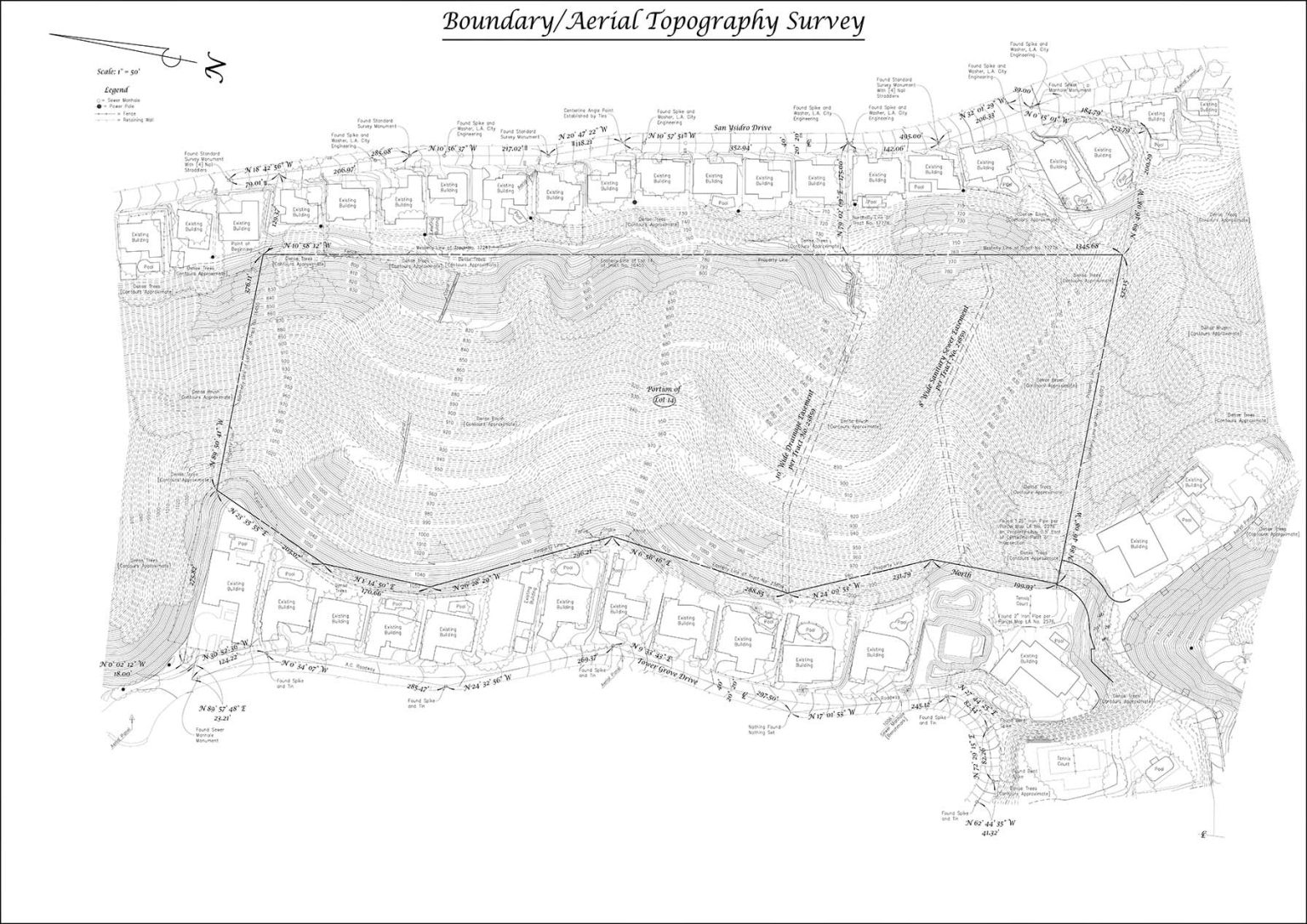
Aerial Topographic Surveys in Los Angeles
If you have a large tract of land that needs surveying, an aerial topography survey can be perfect for quickly determining elevations, terrain and other features.
For over 30 years, we have been providing surveying services to Los Angeles and Ventura Counties. Contact us today for a free quote.
This site is protected by reCAPTCHA, and the Google Privacy Policy and Terms of Service apply.
Why would I need this type of survey?
Large properties or those with steep/rugged terrain may require the use of aerial photogrammetry to collect topographic and feature data.
Some areas may not have vehicle or foot access due to fencing, lack of roads/paths or neighbors’ restrictions.
Some cities and government agencies require maps to show topography and features well beyond the subject property in order to determine buildable area, environmental impact or other factors.
Services
We will provide a map including the following items throughout, and immediately surrounding, the subject property:
Subject property lines
Roads
Buildings (roof footprint)
Visible utilities
Tree Canopies
Contours
FAQ
When can you start?
Our proposal will include an estimated start-date for field work. This service will require an additional 2-3 weeks to gather and process the necessary data. Adverse weather such as fog or rain may impact flight schedules and cause further delays.
Is aerial topography sufficient for design?
Aerial topography is not intended for design use. An on-the-ground survey will be necessary for areas that require a greater amount of detail and accuracy. Contours in areas of dense brush will be approximate.
Will you be setting markers at the property corners?
Setting markers at the property corners or along property lines is not included but may be added for an additional fee. Refer to “Boundary Staking” for more details.
What do you need from us?
We will gather the documents necessary for conducting our survey. If you want us to plot easements you will need to provide a title report and underlying documents. If you cannot provide these documents we can order them for an additional fee.
What is an aerial topography survey?
An aerial topography survey is a modern surveying method that uses drones or aircraft equipped with cameras and LiDAR technology to capture detailed land elevation data from above. This process creates accurate 3D models and topographic maps, which are essential for construction planning, land development, and environmental studies.
Unlike traditional ground-based surveys, aerial surveys allow large areas to be covered quickly and efficiently, reducing the time and labor required. At M&M&Co, we specialize in using advanced aerial technologies to deliver precise, high-quality results that meet the unique needs of your project.
What are the benefits of using aerial surveys for topography?
Aerial surveys provide several key advantages that make them an ideal choice for topographic mapping. They are highly efficient, allowing large tracts of land to be surveyed in a fraction of the time it would take using traditional methods. The advanced equipment used in aerial surveys, such as LiDAR, ensures a high level of accuracy, even in areas with dense vegetation or difficult terrain.
By conducting surveys from above, this method also enhances safety by minimizing the need for surveyors to navigate hazardous areas. Additionally, aerial surveys are often more cost-effective, as they require less time in the field and fewer resources. We leverage these benefits to deliver reliable and cost-efficient surveying solutions for a wide range of projects.
What is the difference between aerial and traditional topography surveys?
The primary difference between aerial and traditional topography surveys lies in the method of data collection. Aerial surveys utilize drones or aircraft to capture elevation data from above, while traditional surveys rely on ground-based equipment such as total stations and GPS devices.
Aerial surveys are typically faster and better suited for large or remote areas, as they can collect extensive data without the need for physical access to the site. On the other hand, traditional surveys are often used for smaller, localized areas where finer detail is required.

